Introduction
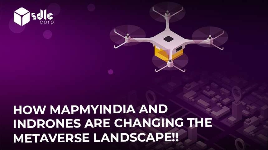
Metaverse Landscape: Indrones Solutions Private Limited, an end-to-end drone solutions startup, will get 7 crores from MapmyIndia. This is a strategic investment (Indrones). As part of this deal, MapmyIndia has bought a 20% stake in Indrones. With the new money, Indrones will expand its operations, add to the thousands of hours it has flown, and try to give customers more and bigger projects. Indrones makes drones for a wide range of uses and offers drone-based end-to-end solutions for smart cities, government, construction, oil & gas, agriculture, etc. The company has also developed technologies that make data collection, processing, and analytics much more efficient and cost-effective.
“We are happy to welcome MapmyIndia to the team because they share our goal of helping India’s digital economy grow. Drones are now solving some of the most complicated problems in industries like mining, construction, oil and gas, infrastructure, agriculture, etc. “Pravin Prajapati, Founder & CEO of Indrones, said that the company is here to help its customers with their digital transformation by using MapmyIndia’s software maps, geospatial software, and IoT technologies.”
MapmyIndia’s Chief Marketing Officer, Rakesh Verma, said, “Drones are a new industry with a lot of potential and market opportunity. Our strategic investment in Indrones is in line with our Prime Minister’s vision of Aatmanirbhar Bharat and making India a drone hub by 2030. The people who work for Indrones have a lot of experience, and we are sure that together we can be a leader in the Indian and global drone industries. We’re excited to work with Indrones on a strategic level to improve our drone-based solutions and services. This will help us meet the needs of both our large base of enterprise customers in different industries and consumers with cutting-edge drone capabilities, he said.
How Indrones Intends to Use this Capital?
Drones gather more data than simply photos and movies. “Once drones have gathered information on the location, size, and volume of the structure, We can obtain information with unlimited use cases. Contrary to drones, it takes a lot of time for a person to measure and collect the same quantity of data. Through the pinewood nematode case in Seogwipo, drones once again showed their efficacy. In order to give essential pest control information, the pine tree forest was subdivided and studied every 10 cm using drone video recordings. 50 people would need a week to collect the data, while two workers using drones could do the task in just three days. The technology begins by collecting and analysing data from drones with AI.
To achieve a powerful goal every company needs a powerful fuel. This fuel is nothing but the funds that a company requires to expand their operations. This funds will help to build Future drones to be totally autonomous machines that work without an operator present and will be powered by AI systems. Drones will be able to make independent judgements based on the data they are analysing in order to fly along a predetermined path while avoiding accidents with other drones, structures, and natural obstacles. We frequently hear about drone swarming, or the interaction of drones in groups. The designers of satellite constellations like Starlink already employ the swarming theory. Drone swarming will be the following stage of development. Commercial drones cost around the same as expensive cars. From the viewpoint of most organisations, maintaining your collection of drones is inefficient when you factor in infrastructure, services, and operators.
As a result, Indrowns have already introduced a new drone use model called Drone-as-a-Service (DaaS), which is an all-inclusive on-demand service. Organizations may do a variety of activities with the aid of DaaS without needing to maintain a fleet of drones of their own. Companies may use drones to survey a broad region, keep an eye on crops or livestock, or even build up a temporary mobile network using floating towers (drones that transmit a signal). Since DaaS is in demand, by utilizing these funds Indrowns can efficiently and effectively advance and grow with new innovations, giving the number one services to its customers.
MapmyIndia, Indrones: Metaverse Change. Now!

Use cases of Drone Technology in Metaverse
Efficiency and Safety in Infrastructure and Construction Projects:
The application of metaverse drone technology can significantly improve the security and effectiveness of infrastructure and building projects. Construction sites may be surveyed, work progress tracked, and even inspections can be carried out using drones. This facilitates the early detection of possible safety issues and enables risk mitigation measures.
Drone inspection and survey capabilities also lessen the need for employees to enter dangerous regions, enhancing safety even further. Since drones can swiftly cover wide regions and collect data that can be processed and used in real-time, this technology can also boost efficiency. Users may remotely pilot and steer drones in real-time by developing a virtual world that can be accessible via the use of virtual reality (VR) (What are VR AR MR XR and Its Differences) headsets or other gadgets.
Example: Skycatch
Skycatch is a business that provides drone mapping services for building projects. Drones are utilized to take high-resolution pictures of the building site and build 3D models that may be used to track development and spot possible problems.
Enhancements to Agricultural Productivity and Resource Managment:
The use of drone technology in the metaverse can also significantly enhance agribusiness production and resource management. Crop monitoring, locating areas that require fertiliser or irrigation, and even spotting insect infestations may all be done with drones that are fitted with sensors and cameras. After being examined, this data enables more exact resource use, increasing agricultural yields and decreasing waste. Further minimising the need for physical labour, drones may be utilised to carry out chores like planting and sowing.
Example: Blue River
Drone technology is used by Blue River to enhance weed management. John Deere purchased Blue River in 2017. Their “See & Spray” technology reduces the need for blanket treatments by using cameras and machine learning algorithms to identify weeds and spray herbicides on a selective basis.
Using Drone Technology to Improve Public Safety and Law Enforcement
Drones powered by the metaverse might improve security while enhancing public safety and law enforcement. Traffic, crowds at events, and even crime scenes may be monitored by VR and AR technology in drones. This increases the possibility that illegal conduct will be discovered and stopped by enabling real-time behaviour monitoring. Drones may be used in search and rescue operations as well, providing the search crews with a significantly enhanced virtual perspective. Furthermore, this technology may be used to monitor significant public events, enhancing public safety.
Example: DJI
DJI is a drone firm that creates drones for law enforcement and public safety. Their drones are outfitted with thermal imaging cameras, high-resolution cameras, and other sensors that may be used to find people who have gone missing, keep an eye on crowds, and find dangerous goods.
Better Logistics and Supply Chain Management
The use of drone technology in the metaverse can also significantly enhance logistics and supply chain management. Delivering goods with drones can speed up the process and lower costs. Additionally, this technology may be used to keep an eye on stock levels, delivering real-time data, and enabling more effective replenishment.
Drones may also be used to carry out jobs like warehouse inspections, lowering the demand for physical labour and raising safety. By using metaverse technology, training can be conducted remotely and more safely, reducing risks and costs associated with traditional training methods.
Explore our other insights!
The Future of eCommerce in the Metaverse with Immersive Experiences
Introduction The metaverse is reshaping the eCommerce industry in once unimaginable ways. Innovative brands like Warby Parker are

Metaverse Virtual Experiences All Questions Answered
Get Your Virtual Reality Groove On: All Your Metaverse Questions Answered Metaverse Virtual Experience: The metaverse is
How NFT is Related to Metaverse?
What Does The Term NFT Refer To? How NFT is related to metaverse is most asking question so
Example: Walmart
In 2021, Walmart submitted a patent for a drone delivery system that would automate the identification and authorization of drones using blockchain technology. A virtual depiction of a real place would be created by the system using metaverse technology, making it easier for drones to navigate and carry products.
Enhanced Customer Experience and Marketing
Businesses may use metaverse drone technology to improve their customers’ experiences as well as their marketing initiatives. The aerial video obtained by using drones to film events, venues, and products offers a fresh viewpoint that can be included into advertising and marketing materials.
Drones may also be used to gather information about customers’ preferences and activity patterns, enabling more precise marketing campaigns. Using drone tours of facilities or products, for example, can enhance the consumer experience provided by this technology.
Example: Amazon
Using delivery drones to carry products directly to consumers’ homes is something Amazon is looking into. Customers would benefit from a quicker and more effective delivery service as a result.
Example: Red Bull
Red Bull has recorded video of their extreme sports events using drones. The video offers a distinctive viewpoint and is utilised in marketing initiatives to interact with the intended audience.
Improved Environmental Monitoring and Conservation
The utilisation of metaverse drone technology can also help with environmental monitoring and protection. Drones with sensors and cameras may be used to track ecological changes, spot alterations in the environment, and locate locations that need conservation work.
Additionally, this technology may be used to track down unlawful acts like hunting and deforestation, as well as to keep an eye on animal populations. Drones can also be used in rescue and recovery operations after disasters, giving a bird’s-eye perspective of the impacted regions. The potential for drones and metaverse technology to change industries and business processes will certainly increase as the technology develops and new, creative uses and applications start to appear.
Example: Conservation International
Drones have been used by Conservation International to track land use and deforestation in the Amazon jungle. Drones are able to take pictures of the forest in high-definition and monitor changes over time to spot at-risk regions.
Example: World Wildlife Fund
Drones have been employed by the World Wildlife Fund to keep an eye on wildlife populations and their habitats. Animals may be photographed by drones from the air, allowing researchers to follow their travels and track population trends.
MapmyIndia and Indrones: Metaverse Evolution. Explore Today!
Increased Research and Development Capabilities
Businesses and organisations may employ metaverse drone technology to boost their research and development capacities. Drones may be used to gather data for scientific projects, including following animal migrations, observing weather trends, and even taking samples.
This technology may also be used to examine brand-new goods and innovations, offering a distinct viewpoint that might encourage innovation. Drones may also be used to collect data for scientific study, which is a more affordable and effective option than using conventional techniques. Creating a virtual environment can enable more precise and efficient control of the drones, particularly in applications that require high accuracy or safety, such as surveillance, inspection, or search and rescue operations.
Example: IBM
IBM has monitored and analysed crop data using drones for agricultural studies. In order to manage crops and maximise yields, the drones can take high-resolution pictures and utilise artificial intelligence to evaluate the data.
Enhanced Accessibility and Connection
Enhanced accessibility and connectivity are further advantages of metaverse drone technology. In rural or difficult-to-reach places, drones can be utilised to deliver internet connectivity, allowing communication and information access.
In order to increase access to healthcare, this technology may also be utilised to ship medical supplies and equipment to far-off locations. Drones can also be used to deliver disaster aid in locations that are challenging to reach with conventional transportation. Users may cooperate in real-time while exchanging knowledge and insights utilising metaverse technology, increasing the overall efficacy and efficiency of drone operations.
Example: Facebook
Facebook has created a drone called “Aquila” that can bring internet access to remote locations. In order to link people to the internet, the drone can fly at great heights and send data to the ground using laser technology.
Improved Urban Planning and Transportation
Metaverse drone technology can also help with these endeavours. Drones may be employed to track traffic patterns, locate places that need infrastructure upgrades, and even carry out aerial assessments for brand-new construction projects. In addition to facilitating mobility, this technology may also be utilised for package delivery or drone taxis. In order to increase safety and save maintenance costs, drones may also be used to monitor and manage infrastructure, such as bridges and tunnels through AR and VR technologies.
Example: Uber
Uber is looking at using drones for transportation. The business came up with the idea for “Uber Elevate,” which entails employing drones to carry people through the air and avoiding gridlock on the ground.
Example: Wing
Wing is a drone delivery service that Alphabet has created that may be used for in-city deliveries. Urban logistics might be sped up and made more effective with the use of drones because they can travel farther and over traffic faster.
MapMyIndia Company Profile
MapmyIndia develops GIS AI, location-based SaaS, telematics, and digital map data. The 1995-founded company has regional headquarters in Mumbai and Bengaluru and smaller operations around India. It also operates in Tokyo and San Francisco.
MapmyIndia develops geospatial, IoT, and digital maps. It now sell drones and drone services. Its Mappls app for users will offer drone-based 3D and HD maps. Mappls users will have immersive and metaverse experiences.
The company launched “www.mapmyindia.com” in 2004. This site provided free, specialised location-based services, including e-locating existing addresses for last-mile delivery. Internet-enabled phones can also use the services. MapmyIndia gave MagicBricks these services.
MapmyIndia offers desktop and mobile online mapping, navigation, tracking, IoT, and analytics. The company sells plug-and-play on-board diagnostics vehicle trackers, advanced GPS tracking devices, and car in-dash entertainment systems. Navigation includes Street View, public transportation information, and turn-by-turn driving directions. Later, company produced Navimaps, which uses offline vector data to generate 3D city, landscape, and building models for in-car entertainment systems.
All about Indrowns Pvt. Ltd
Indrones, a prominent inventor and service provider in the Indian drone industry, which was founded in 2015. They are renowned for their knowledge of high-resolution data solutions supported by superior drone sensors, which further finds use in a variety of sectors.
Their cutting-edge technology applications are used in precision agriculture, high-resolution aerial mapping and surveying, and infrastructure planning using 3D construction and landscape modelling. As a drone technology innovator in the Indian subcontinent, they are recognised for having one of the largest numbers of successful drone flights and are trusted to provide prestigious businesses with dependable and inexpensive drone solutions.
Before Indrones became a legally recognised business, their founding team had won first place in the 2013 SAE Aero Design Competition in Dallas, Texas, USA. Two years later, the team’s unwavering commitment to developing technology for India while simultaneously gaining international exposure resulted in the formal launch of all the ambitions that had been developed under the roof of Indrones.
At Indrones, they prefer to think of drones as an advance tools whose potential is multiplied by the inclusion of strong sensors and cameras that allow for amazing insights into physical domains.
They are dedicated to providing India Inc. with revolutionary drone technology that is practical and simple to use without compromising the solutions’ accessibility, dependability, or safety. Since the beginning, their goal has been to become a high-resolution data solutions company that assists various businesses in making more cost-effective judgements.
Under the “Drone as a Service” (DaaS) model, Indrones has already worked with a number of clients in India. MapmyIndia’s strategic investment will help the company improve its products and services and come up with digital solutions for the drone industry.