

Anchorage geofencing compares vessel observations with approved zone boundaries to produce events such as entry, dwell and exit. A geographic information system (GIS) supplies the spatial context, but event behavior also depends on observation quality and timing rules.
A position near an edge or a gap in updates can change the result. The application must retain the zone version and explain how uncertainty affects an event before that event is used in an operational workflow.
Define Approved Anchorage Polygons And Map Layer Versions
The GeoJSON specification defines position coordinate order as longitude then latitude. Check the actual source format rather than assuming all interfaces use that order. Build zone event rules around the boundaries and restrictions approved by the port.
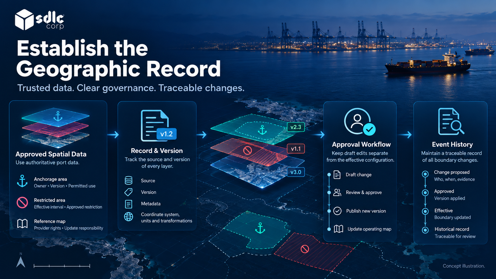
Use authoritative, approved spatial data for operational boundaries. Record the source and version of every zone, restriction, and relevant map layer. Keep draft edits separate from the effective operating configuration. A boundary change should follow an approval process and remain traceable in historical event review.
| Layer | Governance requirement |
|---|---|
| Anchorage area | Owner, version and permitted operational use |
| Restricted area | Effective interval and approved restriction |
| Reference map | Provider rights and update responsibility |
| Vessel observation | Source, time and uncertainty |
| Event history | Boundary version and triggering evidence |
Do not treat a generic web map as a substitute for the port's approved geographic information. Determine the coordinate reference system, units, and transformation rules with the source owner before importing data.
Check licensing, caching rights, offline behavior, update delivery, attribution, and service limits. A provider choice affects both the technical design and the support model. Ask how the application operates when background tiles fail but operational data remains available.
GeoJSON longitude/latitude order does not transform an input supplied in a local projected coordinate system. Identify the source reference, axis order and units, apply the approved transformation, then check control points and boundary validity before publishing a new zone version. Retain the transformation version so an earlier event can be reproduced.
Define Entry, Exit And Dwell Semantics
Define N, the number of consecutive valid observations needed to confirm a crossing, and T, the dwell duration. The port must approve how jitter, missing observations and uncertainty affect each rule. Choose and validate values for the intended task before applying them operationally.
Translate A Geographic Crossing Into A Defined Event
Agree whether an event requires one observation or sustained evidence. Discuss boundary jitter, repeated observations, missing updates, and uncertain positions. These conditions can create misleading event streams if the implementation simply toggles a flag whenever a point crosses a line.
Represent candidate, confirmed, suppressed, and reviewed events where the workflow needs those distinctions. The application should explain why an event fired and which observations supported it. Source-aware vessel tracking provides the observation model; the allocation approval workflow determines whether any operational state should change.
Entry, Dwell And Exit Against Boundary Version 7
Illustrative example
This sandbox zone uses local test coordinates, not a real geographic boundary. The general rule uses N consecutive valid observations and a dwell threshold T. In this test fixture only, N = 2 and T = 120 seconds. A configured edge band marks uncertain positions for review.
| Time | Position Classification | Expected Event |
|---|---|---|
| 10:00:00 | Outside zone Z-A version 7 | None |
| 10:00:10 | First inside observation | Entry candidate only |
| 10:00:20 | Second inside observation | Entry E-1 confirmed; effective time 10:00:20 |
| 10:00:25 | Inside edge uncertainty band | No exit; pause dwell accumulation |
| 10:02:25 | Valid inside evidence; five-second uncertainty pause excluded | Dwell D-1; 120 confirmed seconds accumulated |
| 10:03:00 and 10:03:10 | Two valid outside observations | Exit X-1 at 10:03:10 |
Version Changes And Jitter
| Edge Case | Stored Result | Behavior To Avoid |
|---|---|---|
| Boundary version 8 starts at 10:04 | New classifications use version 8; E-1 retains version 7 | Recalculating history against today’s boundary |
| One noisy outside point between inside points | Candidate exit cancelled when valid inside evidence resumes | Repeated entry/exit alarms |
| Source goes stale before dwell is reached | Dwell pending; uncertainty visible | Assuming continuous presence from silence |
The event record includes zone Z-A, boundary version 7, source observation identifiers and the configured rule version. Those fields let a reviewer reproduce E-1. Entry is an observed zone event; allocation approval remains a separate record.
Reproduce The Boundary Test From Coordinates
For this sandbox only, version 7 is the square with corners (0,0), (100,0), (100,100), (0,100) in local metres. Its five metre edge band is classified as uncertain. The coordinates describe the test square; they are not geographic positions.
| Observation | Coordinate | Classification / Event |
|---|---|---|
| O-1 at 10:00:00 | (-10,50) | Outside |
| O-2 at 10:00:10 | (10,50) | Inside; first entry candidate |
| O-3 at 10:00:20 | (15,50) | Inside; confirm E-1 |
| O-4 at 10:00:25 | (3,50) | Edge uncertainty; pause dwell accumulation |
| O-5 at 10:00:30 | (15,50) | Confirmed inside again; resume accumulation |
| Fresh inside observations continue | (15,50) | Dwell fires at 10:02:25 after 120 confirmed seconds |
{
  "event_id": "E-1",
  "event_type": "zone_entry",
  "track_key": "test-track-9",
  "zone_id": "Z-A",
  "boundary_version": 7,
  "rule_version": "two-sample-entry-v1",
  "evidence": [
    "O-2",
    "O-3"
  ],
  "effective_at": "2026-09-18T10:00:20Z"
}
A single outside point followed by a valid inside point does not satisfy the two outside observation exit rule. Source staleness pauses the dwell timer too; it cannot accumulate confirmed presence from silence. Version 8 affects new classifications from its effective time and does not rewrite E-1.
Keep Rules Outside The Map Renderer
The map displays geography and evidence. Approved rules determine the business interpretation. Separating them makes it easier to test a rule, change a map provider, or investigate an event without relying on visual inspection alone.
For example, a dwell alert should identify its area, start condition, observation gaps, and rule version. If the feed becomes stale, the application should not continue presenting a precise duration without qualification. Show the uncertainty and direct the user to the approved verification process. Environmental data and operating thresholds may add context, but those thresholds also require explicit ownership.
Decide which zone events inform a user and which open a workflow exception. That choice belongs in the anchorage application scope, alongside approval responsibilities.
Design A Map That Supports Review
Provide a legible legend, selectable boundaries, and a detail panel that explains the current selection. Keep a text based event list available for keyboard users and for tasks that do not require geographic navigation. Long labels should wrap, and controls should remain usable when the viewport narrows or text is enlarged.
Avoid using red and green as the only distinction between normal and exceptional states. Name the state and provide the time and source. Make historical replay clearly different from live viewing. A user reviewing yesterday's boundary should not mistake it for the current operational configuration.
Test Boundary Jitter, Missing Positions And Polygon Changes
| Scenario | Acceptance question |
|---|---|
| Target oscillates near a boundary | Are repeated alerts controlled and explained? |
| Observation becomes stale | Is the event state qualified rather than inferred without evidence? |
| Polygon changes | Can historical events retain the earlier version? |
| Map tiles are unavailable | Can users still inspect operational records? |
| Coordinate mismatch | Is invalid spatial data rejected before use? |
Use representative coordinates approved for testing, not a live navigational instruction. Include permission checks on zone editing and verify that an unauthorized user cannot activate a draft boundary. Geographic acceptance scenarios should cover the event engine and the interface separately.
Test map rendering and geofence processing separately under representative target counts and update bursts. If symbols are clustered at wide zoom, preserve access to individual targets and unresolved alerts. Background tile failure must not hide source age or remove the accessible event list.
Define Acceptance And Ownership For Geofence Changes
Name who proposes, checks and approves a boundary change. Keep the draft separate from the active version and record its effective time. A user reviewing an earlier event must be able to see the geometry and rule version used then, even after the current map changes.
Before activation, identify allocations and pending requests affected by the new geometry. Agree whether each needs review, grandfathering under an approved policy or another explicit treatment. Do not silently move an existing allocation because the polygon changed. Record the decision and notify the responsible workflow owner.
Test activation, rejection of an unauthorized edit and recovery from an incorrect version. A rollback must identify which configuration is restored and how events produced during the intervening period are reviewed. It should not erase the change history.
Accept the feature when reviewers can reproduce a sample event, identify its boundary version and trace any resulting operational action. Assign ongoing ownership for map data, event rules and change approval before go live.
Conclusion
Replay positions across a known boundary and inspect each entry, dwell and exit result. Include an uncertain edge position and a stale interval, checking that dwell time follows the configured pause or reset rule.
Keep geometry changes versioned and test their effect before release. A recorded zone event should remain explainable even after the boundary has been edited.
Review Geofencing Requirements With SDLC Corp
Consider consulting SDLC Corp on the zone and event requirements for the anchorage management software, including custom software development services where needed. Supply approved geometries, coordinate references and local event policies. Ask for a scoped demonstration of boundary versioning, uncertain positions, dwell handling and historical replay, with the operational owner responsible for approving the rules rather than inferring them from software defaults.
Frequently Asked Questions
What Determines A Geofence Event?
The zone geometry, its version, observation quality and configured event rules determine the result. Entry detection and dwell timing are separate decisions; neither should be inferred solely from a dot appearing inside the displayed boundary.
Can Software Set Its Own Safety Buffers?
Use the boundaries and operating constraints approved for the port's procedure. The application can represent and test those settings, but sample geometry or a default buffer is not evidence of an approved navigational limit.
What If The Background Map Is Unavailable?
Show the unavailable state and retain permitted access to relevant records or cached information. Test which tasks remain usable without the map; do not assume that a visible list provides all the context needed for every decision.